Geographic Referencing and Datums
Figure 1: Example of GCP on a base map
Geographic Referencing and Datums
Introduction:
When gathering data for mapping purposes with UAS, there are a few different points of data that a user needs to identify in order to be proficient. Geographic referencing is a a term for when GPS points, or other Ground control points are collected, and then applied to a map or simply stored in a file. Datums are what I will mainly be discussing in this lab, as they are important to geographic referencing. What are datums? Simply put they are reference points, such as the discussed above.
In this lab we used ArcGIS Pro to look into a map previously taken, with many errors in the collection and storage of the data. To an untrained eye the data collected is very incomplete and possibly useless. However, if a user knows what to do they can correct improperly collected and stored data in order to make a complete product.
In the following sections I will be going over some of the basic information a user needs to know in order to use software for Geographic Referencing, with a focus on datums. I will also be going over the data that we were given and how it can be corrected to form a working product.
NOTE: I will not be going into detail on projections in this post, as it will be covered in a later assignment.
Method:
Firstly we need to look into the data given to us in an excel spreadsheet, It is shown below:
Figure 2: GCP given
Of the data shown above, there is a lot wrong with the information, such as the Y values being negative, unclear labeling, and data being out of order.
There are other important files in this section, such as the metadata file. In operations, this file will function as a single source of truth, containing relevant information from the operation. However, in this exercise the metadata we are given is greatly lacking in information.
Next we opened up this data set, without changing anything, in ArcGIS and seeing what happens. Below is shown where this leads.
Figure 3: Antarctica
The operation obviously did not take place in Antarctica, so changes need to be made. This is because the values are backwards.
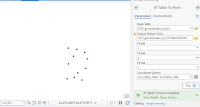
Now opening the proper data set, we will be able to see where the GCP should properly be on the base map. Below is each object and control point with their Z coordinate. There are issues with there labeling, and they are out of order.
ObjectID 1: Z= 246.7
ObjectID 2: Z= 243. 69
ObjectID 3: Z= 241.37
ObjectID 5 but it is called control 04: Z=
247.98
Object ID 4 but is called control 09: Z= 249.04
ObjectID 6, Control 07: Z= 270.51
ObjectID 7, Control 00: Z= 280.1
ObjectID 8, Control 06: Z= 280.58
ObjectID 9, Control 05: Z= 271.96
ObjectID 10, Control 08: Z= 266.98
ObjectID 11, oomFlag 3: Z= 263.61
After this we switched to ArcGIS earth, but still using the same data set. Opening the data table to look at the elevation we see that the elevation values have an error of around 140m between the datums and the real value. This is a datum issue that needs corrected.
Next we will be applying changes in order to fix the data, to do so we need to look at online geographic data sets. Linked below is the website we used:
From this database we can find the marker for the area the operation took place in.
Figure 4: Datasheet used
After going through the datasheet and applying that information to our data sets, we can achieve corrected values. These values are shown below:
ObjectID 1: Z= 212.848
ObjectID 2: Z= 209.837
ObjectID 3: Z= 214.127
ObjectID 5 but it is called control 04: Z= 214.127
Object ID 4 but is called control 09: Z= 215.187
ObjectID 6, Control 07: Z= 236.657
ObjectID 7, Control 00: Z= 246.247
ObjectID 8, Control 06: Z= 246.727
ObjectID 9, Control 05: Z= 238.107
ObjectID 10, Control 08: Z= 233.127
ObjectID 11, Flag 3: Z= 229.757
Conclusion:
Knowing how to calibrate datums and other data collected is very important. There may be times in you work when you are given data sets that are not very accurate or good. Knowing how GCP coordinates work in software such as ArcGIS is very important, as well as knowing how to correct errors. Being proficient in this is vital as it allows you to fix errors made.


Comments
Post a Comment